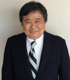
Prof. Masaji Watanabe
Emeritus Professor, Specially Appointed Professor (Research), Okayama University, Japan
Title: Study of system for recording and processing data in generation of topographic surface of water area
Abstract:
One speculates that the frequency of heavy rain events
will increase with progress of the climate change. In view of disaster
prevention and reduction, it is important to develop systems for prompt
updating various data concerning rivers, reservoirs, and coastal waters.
Our study focuses on developing systems for recording and
processing topographic data in water areas in generation of topographic surfaces. A hard ware system consisting mainly of a GPS receiver
and an echo sounder unit records positional data and depth data. Positional
data and depth data are combined to be three-dimensional data that represent
points on the topography of a water area. Piecewise linear functions defined on
a sequence of triangular meshes represent a topographic surface of a water
area.
Biography:
Masaji
Watanabe, Emeritus Professor, Specially Appointed Professor (Research), Okayama
University, is active in research fields of applied mathematics. Those include a
study on topographic surfaces of water areas. His recent activities include
joint studies on measurement and analysis of underwater topography with Mr. Satoshi Iwakami, Mr. Masahiko Tamega, Mr. Masahide Sanada, Mr. Michiaki Mohri, Mr. Yoshitaka Iwakami, Mr. Naoki Okamoto, Mr. Eishi Mitsui (Earth
Rise Company, Inc., Okayama, Japan), Professor Hidetaka Chikamori (Graduate School of Environmental and Life Science, Okayama
University), and Dr Shuji Jimbo (Visiting Researcher,
Graduate School of Natural Science and Technology, Okayama University, Okayama,
Japan).