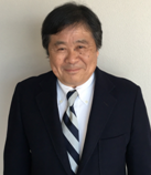
Prof. Masaji Watanabe
Emeritus Professor, Specially Appointed Professor (Research), Okayama University, Japan
Title: Measurement based analysis for change of topography in water area
Abstract:
Recent heavy rain events brought tremendous human damages
and material damages. Speculation is that frequency of disastrous heavy rain
events will increase as the climate change progresses, and the prevention from
their damages requires various data concerning rivers, reservoirs, and coastal
waters. Our study demonstrates analysis of topographic change in a water area, which
is based on measurement data. A GPS receiver or a GNSS receiver, and an echo
sounder unit mainly constitute a hard ware system to generate three-dimensional
data. Those data are processed in a further analysis for investigation of
change in the topography.
Biography:
Masaji
Watanabe, Emeritus Professor, Specially Appointed Professor (Research), Okayama
University, is active in research fields of applied mathematics. Those include a
study on topographic surfaces of water areas. His recent activities include
joint studies on measurement and analysis of underwater topography with Mr. Satoshi Iwakami, Mr. Masahiko Tamega, Mr. Masahide Sanada, Mr. Michiaki Mohri, Mr. Yoshitaka Iwakami, Mr. Naoki Okamoto, Mr. Eishi Mitsui (Earth
Rise Company, Inc., Okayama, Japan), Associate Professor Ryosuke Akoh (Faculty of Environmental, Life, Natural Science and
Technology, Okayama University), and Dr. Shuji Jimbo (Visiting Researcher, Graduate School of
Natural Science and Technology, Okayama University, Okayama, Japan).