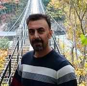
Prof. Saleh Yousefi
Agricultural Research, Education and Extension Organization (AREEO), Iran
Title: Leveraging AI and Machine Learning for Multi-Hazard Modeling in Mountainous Areas
Abstract:
This presentation explores the application of advanced artificial intelligence (AI) and machine learning (ML) techniques, including reinforcement learning (RL) and deep learning (DL), for multi-hazard modeling in the semi-arid, mountainous region of Chaharmahal and Bakhtiari Province, Iran (1,655,300 ha). Focusing on wildfires, floods, and landslides, the study integrates RL models (Q-Learning, Proximal Updating, Deep Q-Learning, RL-Stack), ML models (Random Forest, AdaBoost), and DL models (Convolutional Neural Network, Long Short-Term Memory) to develop high-resolution susceptibility maps. A comprehensive dataset, including wildfire (206 points), flood (545 points), and landslide (1040 points) inventories, was compiled from historical records (1983–2023), field surveys, and local reports. Collinearity analysis reduced environmental variables (e.g., NDVI, slope degree, rainfall) to eliminate correlations (>0.7), ensuring robust model inputs. Models were trained and validated on split datasets, with susceptibility zones classified into five categories (Very Low to Very High) using the natural break algorithm. Results highlight the superior performance of Proximal Updating (PU) for wildfires (AUC 0.9237, RMSE 0.3445) and floods (AUC 0.9322, RMSE 0.3208), with RL-Stack providing balanced ensemble predictions. For landslides, Long Short-Term Memory (LSTM) and Convolutional Neural Network (CNN) excelled (AUC 0.9102 and 0.8938, respectively). Key predictors included NDVI, Distance from Roads, and Vegetation Type for wildfires; Snow Depth, Flow Accumulation, and Distance from Residential Area for floods; and Slope Degree, Rainfall, and Distance from Fault for landslides. These findings underscore the sensitivity of AI models to dynamic environmental drivers, enabling precise delineation of high-risk zones in counties like Shahrekord, Ardal, and Lordegan. The study pioneers RL and DL applications in multi-hazard modeling, offering practical frameworks for targeted mitigation strategies, such as fuel reduction near roads for wildfires and land-use planning for landslides. By addressing climate-exacerbated hazards, this work advances AI-driven environmental management and ecological restoration, with implications for disaster resilience in vulnerable regions.
Biography:
Dr. Saleh Yousefi is an accomplished Assistant Professor in Watershed Management at the Agricultural Research, Education and Extension Organization (AREEO) in Tehran, Iran, with over eight years of experience in environmental modeling, ecological restoration, geomorphology, and natural hazards modeling. Holding a Ph.D. in Science and Engineering of Watershed Management from Tarbiat Modares University, Dr. Yousefi has developed expertise in leveraging advanced computational tools, including machine learning (ML), artificial intelligence (AI), and reinforcement learning (RL), to address critical environmental challenges such as landslides, floods, wildfires, and land degradation. His innovative research integrates remote sensing, GIS, and AI-driven modeling to enhance disaster risk assessment and promote sustainable land-use practices in vulnerable, semi-arid, and mountainous regions.
Dr. Yousefi’s academic journey includes an M.Sc. in Watershed Management and a B.Sc. in Watershed and Range Management, both from Iranian institutions, complemented by a sabbatical research stint at École Normale Supérieure (ENS) in Lyon, France, where he studied river morphological changes under the guidance of Prof. Herve Piegay. His professional experience spans roles at AREEO, Shizuoka University (Japan), and the Forest, Range and Watershed Management Organization (FRWO) in Iran, where he contributed to projects on sediment disaster management, debris flow monitoring, and sustainable land and water resource management. He has collaborated with international teams, engaged with local communities, and communicated with UN councils to advance environmental sustainability.
A prolific researcher, Dr. Yousefi has published numerous peer-reviewed articles and led over 12 national and international projects. His recent work focuses on ML-driven models for multi-hazard risk assessment, including grain size detection in debris flows and land degradation monitoring, aligning with global priorities in climate resilience and soil health. His contributions have earned him prestigious accolades, including the Best Researcher in Natural Resources Science in Chaharmahal and Bakhtiari Province (2020, 2024), the Best Educator in 2025, and first place in the 2022 National Technological Event for optimizing AI methods in land-use mapping.
As an energetic and responsible scholar, Dr. Yousefi is committed to advancing AI-driven environmental management and fostering academic exchange. His keynote presentation at CSWCER 2025 will showcase practical applications of AI and ML in multi-hazard modeling, offering actionable insights for ecological restoration and disaster mitigation. Dr. Yousefi resides in Shahrekord, Iran, and is accessible via email (ssaleh.yousefi@gmail.com, s.yousefi@areeo.ac.ir). His work can be explored further through his ORCID profile (0000-0002-7198-4612) and Google Scholar page.